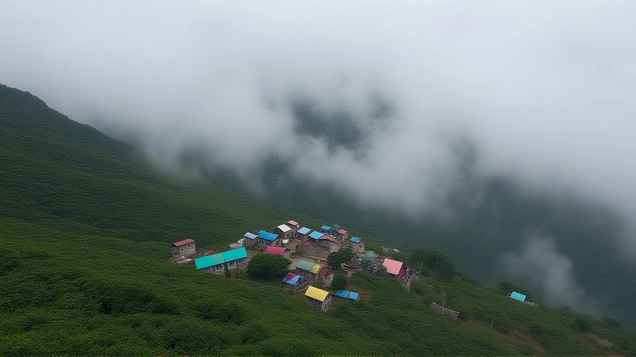
On Tuesday, October 28, 2025, residents of Uttarakhand woke up to biting cold, with morning temperatures plunging to 13°C in Dehradun while the afternoon heat soared to 25°C — a staggering 12-degree swing that’s nearly double the seasonal norm. The Dehradun Meteorological Centre confirmed the anomaly, attributing it to a dry, clear sky by day and rapid radiative cooling at night. But the real story isn’t just the chill — it’s the looming cyclone. Cyclone Montha, churning across the Bay of Bengal at 110 km/h, is set to unleash heavy rains across nine states, with Bagheshwar, Pithoragarh, and Champawat bracing for the first deluges as early as Wednesday.
Why the Extreme Temperature Swing?
It’s not unusual for hill states to see cold nights, but this gap — 12 degrees in a single day — is extreme even for October. In Dehradun, the maximum of 25°C is 4 degrees above average, while the minimum of 13°C is 5 degrees below. That’s not just a cold snap; it’s a climate signal. The clear skies, caused by a weakening monsoon withdrawal, let heat escape rapidly after sunset. Meanwhile, dry air over the plains absorbs less moisture, preventing cloud cover that could trap warmth. In mountain towns like Karnaprayag and Shrinagar, daytime highs hit 31°C, but nights dip below 8°C — a 23-degree swing that’s alarming for farmers and elderly residents alike.
Where the Rain Is Coming — and When
The Dehradun Meteorological Centre issued a four-day rainfall alert from October 29 to November 1, with the heaviest downpours expected on the 28th and 29th. Six districts — Uttarkashi, Rudraprayag, Chamoli, Bagheshwar, Pithoragarh, and Champawat — are under ‘moderate to heavy rain’ watch. Light showers were already reported in the Kumaon hills on Tuesday. The trigger? A deep depression over the Bay of Bengal that’s intensifying into Cyclone Montha, projected to make landfall near Kakinada by November 1. Its outer bands are already feeding moisture into the Himalayan foothills.
What This Means for Daily Life
For farmers in Bagheshwar, the rain is a mixed blessing. The October crop cycle is winding down, but unseasonal showers could damage stored potatoes and ginger. “We’ve seen this before — a dry October followed by sudden rain,” said local grower Ramesh Singh. “This time, it feels different. The cold is deeper, the wind sharper.” In urban centers like Dehradun and Rudrapur, hospitals are seeing a 30% spike in respiratory cases among children and the elderly. Power utilities are on alert for landslides that could knock out lines in the higher reaches.

Broader Implications: A Pattern Emerging?
This isn’t an isolated event. Over the past five years, Uttarakhand has seen a 40% increase in the frequency of day-night temperature gaps exceeding 15°C during October. Climate scientists link this to reduced moisture retention in the soil and shrinking forest cover in the lower Himalayas. Meanwhile, the Bay of Bengal’s cyclone season is growing longer and more intense — 2025 has already seen four named storms, up from an average of two in the decade prior. Cyclone Montha is the latest in a string of systems that are forming farther north and moving faster — a trend climate models predicted would accelerate by 2030.
What’s Next?
The next 72 hours are critical. The Dehradun Meteorological Centre has activated its emergency response team and is coordinating with district administrations in the six at-risk zones. Schools in Pithoragarh and Champawat have been advised to remain closed on October 29. Meanwhile, the state’s disaster management department is pre-positioning relief supplies in remote villages accessible only by foot. By November 2, temperatures across the state are expected to drop further — with Manali already registering 8°C and Srinagar at 19°C, signaling the early arrival of winter.
How Other Cities Are Faring
While Uttarakhand shivers, other parts of India are experiencing their own extremes. Delhi NCR faces a mild 28°C day and 17°C night — a comfortable 11-degree gap. Mumbai and Kolkata remain humid and warm, with highs near 33°C. But the real contrast lies in the hills: Manali at 8°C and Srinagar at 19°C show how sharply climate zones are shifting. Even Jaipur, usually hot in October, is cooler than normal at 21°C — a sign the cold front is pushing southward faster than usual.
Frequently Asked Questions
Why is the day-night temperature difference so extreme in Uttarakhand this October?
The extreme gap — up to 12°C in Dehradun and over 20°C in higher areas — is due to clear skies, low humidity, and rapid heat loss at night. Dry air prevents cloud formation, allowing heat to escape into space. Combined with reduced forest cover, this creates a ‘heat sink’ effect where days are warmer than usual and nights much colder.
Which areas in Uttarakhand are most at risk from Cyclone Montha?
The six districts under heavy rain alert are Uttarkashi, Rudraprayag, Chamoli, Bagheshwar, Pithoragarh, and Champawat. These areas lie directly in the path of moisture-laden winds from the Bay of Bengal. Pithoragarh and Champawat, being in the eastern Himalayas, are especially vulnerable to landslides and flash floods.
Is this level of rainfall normal for October in Uttarakhand?
No. October is typically dry in Uttarakhand, with rainfall averaging less than 20mm. This year, forecasts predict over 70mm in the alert zones — nearly four times the norm. The last comparable event was in 2018, when a late cyclone caused widespread damage. Experts say climate change is making these ‘out-of-season’ storms more frequent.
How is Cyclone Montha different from other cyclones in recent years?
Cyclone Montha is forming farther north than usual and intensifying rapidly — a trend seen in 7 of the last 10 Bay of Bengal cyclones. With sustained winds of 110 km/h, it’s stronger than average for this time of year. It’s also moving faster, reducing warning time for inland regions. This pattern aligns with climate models predicting more intense, faster-moving cyclones due to warmer sea surface temperatures.
What should residents do to prepare?
Residents in the six alert districts should secure loose items, stock up on essentials like water, medicines, and dry food, and keep radios charged. Avoid travel to hilly areas. Elderly and children should stay indoors during peak rain hours. The state government has set up 127 relief centers — contact numbers are available via the Uttarakhand Disaster Management Portal.
Will this cold spell last beyond November?
Yes. With Cyclone Montha pulling moisture northward and a strong high-pressure system settling over Tibet, cold air is being funneled into the Himalayas. Temperatures are expected to remain 3–5°C below average through mid-November. Snowfall may arrive early in higher elevations like Auli and Kedarnath — a rare occurrence before mid-November in recent decades.
Leave a comments